
Agriculture Industry Beginning to Adopt UAS Technology
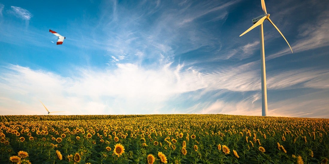
Farmers and researchers within the agriculture industry are starting to adopt UAS technology in light of recent technology advancements in small UAS and reasonable access to affordable sensors.
In theory, it allows the user to access a precise location, observe it with a plethora of sensors, and create maps of multivariate data. Growers are using them to detect pests, map weeds, assess growth, analyse moisture content to assist with irrigation or drainage, and optimise nutrient management. This helps increase yield and conserve valuable resources or limit the use of dangerous chemicals. The fact that the sensors can gather and display data that can impact real-time decision-making is an advantage.
Discussing what kind of impact UAVs can have on farming is about more than just talking about the data made available. For agriculture professionals, it is about how the data gathered by UAVs can be properly utilised and what actions it will lead to.
If it was as easy as theory suggests, we would likely have seen growers adopting this technology on a large scale. It is however much more complex. If we look at just a few of the parameters that affect the data such as soil type, water composition, crop type, climate zone, and season, we quickly see that not only is the problem multivariate, it will also require large number of statistical models to support the analysis to present a more generic solution, enabling larger scale adoption.
Market
Most of the world’s 570 million farms are very small, with 84% of the farms are smaller than 2ha and they operate about 12% of the farmland. 16% of the world’s farms are larger than 2ha and they represent 88% of the world’s farmland. Approximately 2% of all the world’s farms are larger than 20ha (50 acres), which is the equivalent of 11.4 million farms that immediately could benefit from UAV operations, given the available analysis tools and statistical models.
From an UAV technology perspective, there is a view of agriculture as a homogeneous marketplace. But treating it as such is futile, since there are no generic solutions to be found. The UAV industry tends to treat a variety of crops the same way, ignoring the vast differences between wide-acre crops, vegetables, grapes and fruits. The reality being that their practices differ on many levels. UAV technology providers need to consider the complexities and build statistical models for particular crops.
Crop specificity and other physical dependencies needed to be considered, as well as business-related parameters such as economic models and scale.
Being able to find ROI using UAVs is dependent on many factors, and trying to appeal to a wide selection of different crops and business setups is a matter of choice for manufacturers and service providers, but these distinctions are important to recognise. Talking about how UAVs can and will impact precision agriculture while also ensuring that the conversation doesn’t become too general or too specific is essential.
Agriculture UAVs offer increased yields, integrated GIS mapping, crop health imaging, environmental benefits, and time and cost savings, with applications such as crop health and irrigation monitoring, weed identification and variable-rate fertility.
Technology
The widespread availability of UAVs enables agricultural professionals to cost-effectively gather crop health information. UAVs provide useful, high-resolution data from optical, multispectral, NIR and thermal sensors to perform in-depth analysis of crop health.
Historically, researchers’ forays into employing UAVs for this end involved equipping them with thermal cameras to take measurements of canopy-air temperature, which is the basis of a widely used index for water stress in plants.
We see established correlation between a number of sensor types and different agriculture parameters:
- Thermal: irrigation scheduling, plants disease detection, estimating fruit yield, and evaluating maturity of fruits
- Multispectral: identify pests, disease and weeds, provide data on soil fertility, count plants and determine population or spacing issues, estimate crop yield, and measure irrigation. NDRE (leaf chlorophyll content, plant vigor, stress detection, fertilizer demand, nitrogen uptake)
- RGB + NIR: NDVI, plant health, nitrogen mineralisation
Through specialised software and statistical analysis, it will be possible to draw conclusions from sensory data, but as agriculture is not a homogenous operation, there will be need for significant statistical models covering different soil types, water compositions, crop types, climate zones and seasons.
Limitations of precision agriculture utilising UAVs
Precision agriculture utilising UAVs has its benefits but is mostly used on a small scale. Under current regulations, all measurements need to take place within visual line-of-sight (VLOS) of the operator. Operators could conduct several operations in a day by moving from section to section and combining the results into data maps for large farms, but this is not as effective as doing it all at once.
Finding out if major technology providers have the expertise to offer solutions that are specifically related to a particular crop is a separate issue. It can be difficult, as these services and tools cannot become so specific that they’ll end up being unique for each grower, but not so generic that the solution is no longer able to provide specific data.
ROI
From the ability to collect data from, and analyse individual plants, to getting information on the moisture content of soil, the industry has seen how UAVs can deliver ROI for both growers and agronomists, and see a financial ROI in UAS technology is a major consideration for growers.
It takes an investment of time from the growers to see how the sensory data gathered from a UAV relates to what is happening on their fields, as growers need it to provide context and create a correlation before making informed decisions. This has led to growers seeing how the technology can be utilised as they create value propositions that make financial sense.
ROI can be realised with drones as part of a solution, but anyone who plans to solely rely on drones to make decisions is likely to be disappointed. That said, as part of an ecosystem, UAVs can provide key pieces of information which will directly influence decision-making.
