
Nearly twelve years on from the launch of Google Maps, it is hard to remember a time when everyone did not have ready online access to global satellite imagery. But, while for keyboard tourists it may not matter if the picture they are seeing is three years old, for security and defence tacticians it’s a different matter altogether.
Go deeper with GlobalData

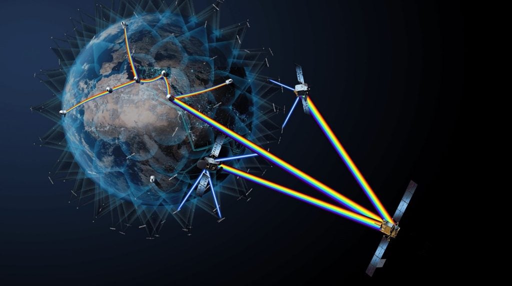
This is where Airbus Defence and Space’s new geo-spatial offering, One Atlas comes in. The newly launched service is claimed to be the world’s most refreshed 1.5m resolution satellite image library for defence, intelligence and security applications.
“GEOINT [geo-spatial intelligence] products need to efficiently and effectively create an environment whereby all intelligence sources can be fused and combined” says Benoît Maitrinal, Airbus Defence and Space product manager for One Atlas. “A geo-referenced foundation layer is hence a key component for all GEOINT activities, since it supports the up-to-date visualisation and geographic environment of a country or a region.”
GEOINT basemap
One Atlas represents a major step forward in satellite image services, providing a complete streaming service covering the entire Earth’s landmass, using high resolution, professional grade images less than twelve months old. With 18 zoom levels, a global resolution of 1.5m, rising to 50cm for the world’s major cities, and careful quality control to ensure minimal cloud and haze cover, the product’s GIS-ready, ortho-rectified imagery provides an un-paralleled basemap for military GEOINT.
Once integrated with the user’s own data, One Atlas enables teams, assets and areas of interest to be planned, mapped and located, while the quality of the images means that distances and surfaces can be accurately measured and plotted.
How well do you really know your competitors?
Access the most comprehensive Company Profiles on the market, powered by GlobalData. Save hours of research. Gain competitive edge.
Thank you!
Your download email will arrive shortly
Not ready to buy yet? Download a free sample
We are confident about the unique quality of our Company Profiles. However, we want you to make the most beneficial decision for your business, so we offer a free sample that you can download by submitting the below form
By GlobalDataIn effect One Atlas provides a single streamlined approach, which slashes all the traditional costs of selecting, processing, updating and hosting the images, while allowing them to be seamlessly integrated into user systems, and shared across teams and organisations securely.
Speaking at the launch in September, Bernhard Brenner, head of Airbus Defence and Space’s intelligence business cluster, said: “With One Atlas, we propose a radical change to our clients for the way they access our data. We take care of everything: updating, selecting, processing and hosting – all to make it easier, cheaper and faster for our customers”.
Satellites and the cloud
At the heart of the system lie the satellite images acquired by the Pléiades and SPOT constellations. Pléiades are two very-high resolution satellites capable of providing 50cm product imagery, owned by the French space agency, Centre National d'Etudes Spatiales (CNES) and operated by Airbus which also holds the exclusive commercial rights for their imagery distribution. SPOT 6 and SPOT 7 are both operated by Airbus, SPOT 6 being the company’s own satellite, while SPOT 7 is now owned by Azercosmos. Both deliver 1.5m resolution.
In addition to the individual photographs themselves, the satellite images in One Atlas also contain a wealth of associated metadata for each image, including date, time and angle of acquisition and the amount of cloud coverage.
It all adds up to a large volume of new image data every day, and dealing with the hundreds of terabytes acquired annually led Airbus to look to the cloud for a solution, finally choosing Google Cloud from seven public cloud providers to power the new system. Airbus says the selection was made on the basis of the Google platform’s global scale, low latency and infrastructure capacity, which provides the performance, flexibility and scalability needed and allows for a completely new approach to data storage and dissemination.
So just how much detail does it all hold?
Resolving detail
The images themselves are hand-picked to provide the very best available view. The vast majority of them are taken from a maximum angle of 20 degrees and aim for less than 5% cloud; for what Airbus describes as “difficult areas” that may increase to an angle of up to 30 degrees, and cloud cover of 25%. Those parameters make for some very clear and very detailed images to be displayed.
At 1.5m resolution, it is possible to discern whether farm buildings are barns, silos or residences, spot vehicle tracks through grass and detect basketball, tennis and volleyball courts in urban areas. From a military perspective, it can also allow individual railway tracks, control towers and switching points to be distinguished and identify tracked and wheeled vehicles, field artillery and large river crossing equipment by general type, when in groups.
Moving up to the 50cm resolution Pléiades images, row crops such as corn and soybean can be distinguished from fields containing wheat and oats, saloon cars can be told from estates, individual telephone or electric poles identified and foot trails through barren areas detected. For defence oriented purposes, different models of small or medium helicopters can be told apart and the likes of antennae identified by their shape.
One Atlas offerings
There are two versions of One Atlas available, OneView and OneLive– the former effectively being a one-off ‘frozen’ layer, edited once a year, while the latter benefits from a continuous refresh and additional functionality. Maitrinal says that while both have their uses for the defence market, Airbus has also launched a dedicated offer for the sector, in partnership with IHS Jane’s, called Conflict Atlas, which is based on OneView.
“Conflict Atlas combines Airbus Defence and Space’s satellite imagery with IHS Jane’s data and insight into a powerful new tool for the global intelligence community,” he explains.
The defence-tailored offering consists of whole country and regional coverage at 1.5m resolution, and military sites of interest at 0.5m resolution, to support the high currency and coverage rate requirements of the GEOINT community, updated every year. Service users additionally get access to data and insight from IHS Jane’s, including information concerning military bases, surface-to-air missile sites, terrorism/counter-terrorism events, security news, equipment profiles and specifications.
Future development
It seems that although One Atlas was only launched in September, it is already showing much promise and has garnered interest from a number of potential customers, which Airbus believes bodes well for the product’s near-future commercial development.
“The future tends towards more analytics, and an increase in information sources. Conflict Atlas is a good example of the way things are evolving,” Maitrinal says.
GEOINT systems have come on a long way over recent years, and online map services have now essentially become such a familiar and integrated part of everyday life at so many different levels that it is easy to get a little blasé about the whole thing. However, there is a very big chasm between the needs of online shoppers wanting to see how far away the courier service is with their next delivery, and the demands of the defence, intelligence and security community – and for that, there is One Atlas.