
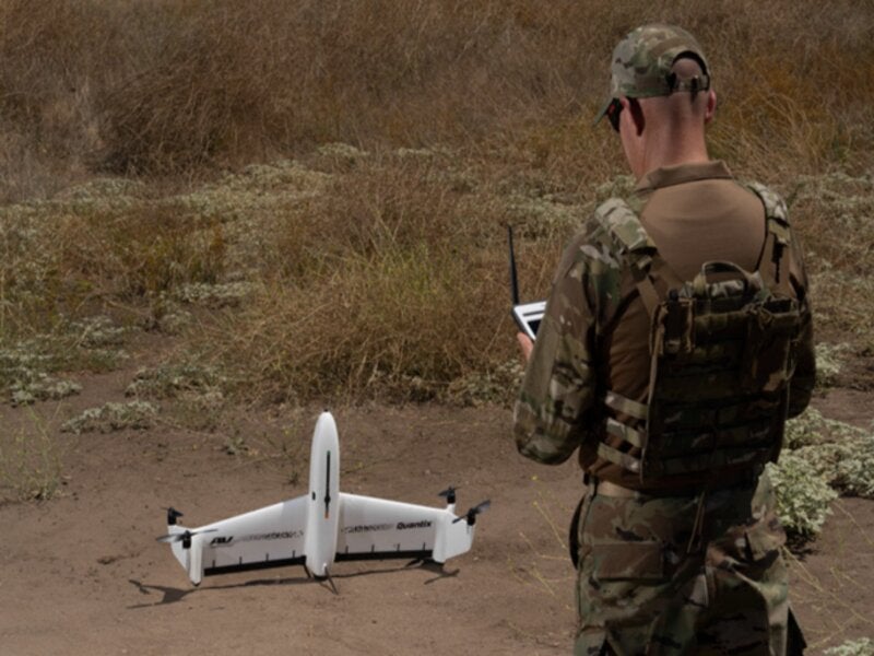
AeroVironment has unveiled a fully automated hybrid vertical takeoff and landing (VTOL) unmanned aircraft system (UAS), Quantix Recon, for defence applications.
The rapidly deployable and lightweight reconnaissance solution has been designed to deliver on-demand intelligence information, including high-resolution georeferenced terrain, vegetation and infrastructure imagery to ground defence forces.
Go deeper with GlobalData

Discover B2B Marketing That Performs
Combine business intelligence and editorial excellence to reach engaged professionals across 36 leading media platforms.
Quantix Recon’s radio frequency silent mode enables it to carry out missions undetected.
The unmanned system accommodates the benefits of a hybrid VTOL design along with the range, speed and efficiency advantages of a multirotor drone.
Quantix Recon can conduct a fully automated flight operation, surveying up to 1.6km² or 20 linear kilometres per 45-minute single battery flight.
Users are permitted to choose between line (route), area and waypoint targeted data capture. This can be done by exercising the multiple automated reconnaissance mode options available.
The aerial imagery data collected is designed to be compatible with multiple available geographic information system (GIS) analytical tools. This will further facilitate analysis.
AeroVironment sales and business development vice-president Rick Pedigo said: “AeroVironment’s Quantix Recon is a low-cost reconnaissance solution that can be in the air within minutes, capturing high-resolution georeferenced imagery of hard to access areas or dynamically changing environments.
“Because it does not rely on radio signals during flight, Quantix Recon offers greater stealth for concealed operations and is unaffected by radio frequency jammers, providing greater protection for frontline troops while reducing cognitive load.”
The UAS will provide a hands-free experience with five optional flight altitudes, ranging from 150ft to 800ft. It has a varied coverage area and image resolution, suiting the mission needs.
Quantix Recon is equipped with dual 18-megapixel cameras, capturing both high-resolution true colour and multispectral georeferenced imagery.
The geospatial imagery can be viewed on the operating tablet using its powerful onboard processing, following the aircraft landing. No other devices, internet or software is required for this.
Furthermore, users can zoom navigation down to centimetre-level ground sampling distance through the tablet’s Quick-Look HD app feature. This will locate critical issues with precision, accuracy and speed.
